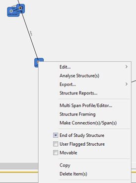
Some functions are available when two or more structures are selected at the same time, that may not show up when just one structure is selected. This enables setting more than one structure with the same data, or performing the same operation on multiple structures at once.


You can select multiple structures at the same time using the Rectangular Mouse Selection Technique or by holding the CTRL key down and left-clicking on additional items. 


Multi Span Profile/Editor

This function brings up the Multi Span Profile Editor Dialog to enable viewing and editing of multiple spans at once.


Reports

Same as in single structure selection, except all selected structures are included.


CSV Exports

Same as in single structure selection, except all selected structures are included.


Export to KML

Same as in single structure selection, except all selected structures are included


Change Structure Type

Same as in single structure selection, except all selected structures are included


Structure Framing

This function enables multiple structures to be framed with power wire attachments according to an available framing standard in an organizational database. The example database has some basic configurations that may prove useful. Alternatively a user could build a new one to their liking. See Structure Framing for more information.


Soil Type Function

This function allows you to view or edit the Soil Type around this structure object, or multiple objects if initiated from the Work Plan area. The choice of Soil Type impacts the holding capacity of anchors and stability of poles. This is one of the functions that allow you to select multiple items at the same time and change the Soil Type for all items at the same time.


Ownership Function

This function helps to identify who owns the structure item involved or which set of Organizational Standards should be the most applicable. If initiated from the Work Plan Area, multiple selected items can have their Organizational setting changed at the same time


Line Grade Function

This function allows you to edit the Grade of the pole line at this point, or multiple objects if initiated from the Work Plan area. Often most of your project will be covered under one Line Grade with higher grades only required in special areas, such as in proximity to or at crossings such as railways. The Line Grade is used to determine the Overload Factors and Strength Factors required for each Structure and the standards base used (NESC/CSA).


Pole Class

This Dialog allows you to set the class of one pole or multiple selected poles at one time.


Pole Install Year

This Dialog is used to record the Installation or Manufactured Date of the pole. This may or may not have an impact on any changes you plan to make to the pole. This information is not mandatory, but will be included in some reports for informational purposes.


Pole Species


In this Dialog you can set the species of wooden pole or manufacturer of concrete pole used. One or multiple poles can be selected and changed at the same time.


Pole Length


You can use this Dialog to set the Pole Length of one or multiple selected poles at the same time.


Changing the Pole Length from one size to another also often requires adjusting the attachment heights for all attachments by the net difference (pole length - depth of setting) for each pole (if applicable). This is expected to be a very common scenario where a pole line is first created in Quick Pole and then the pole is proven to need additional height for road crossings or other clearance issues. So automatically moving all attachments higher should be a time saver. If at least one pole has its length changed, a Dialog will pop up to ask you if you would like the attachment heights automatically adjusted for you.


This is always optional as there are some situations where you DO NOT WANT this to happen; such as when all attachment heights entered are confirmed correct but the pole length needs to change.

Street or Segment Name

This function enables to set the Street field value for all selected structures to the same value.