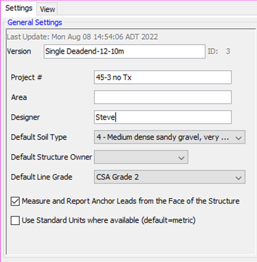
General Settings

Version:
Use this field to distinguish this Design from all others in the Project File. Typically the first Design in a project file is called "Reference" and it contains the "as-is" situation or initial design concept. Subsequent cloned designs from this one would be used to improve or make specific changes to the original (add cables, wires, poles, etc).
Project Number:
This entry can be edited, but normally matches the filename of the Project File.
Area:
This is an additional field that assists in identifying the area that this project is in. You can enter anything such as city, substation identifier, feeder identifier, switching center, wire center, ...
Designer:
Usually enter the name or ID of the person responsible for the Design of this project.
Default Soil Type:
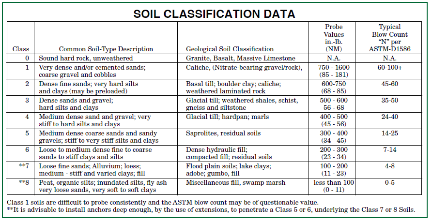
The stability of poles and the holding strength of anchors are dependent on the Class of Soil, as defined in the Universal Soil Classification System and adapted by A.B. Chance Encyclopedia of Anchoring. When creating a new Design, this value is preset based on your default preferences. You should adjust this value to represent the most appropriate default Soil Class for the area the Design covers. This way new poles and anchors added to the Design will already have this value set. You can always change the soil Class for each item in a Design individually, but setting the most appropriate value now can help you save time editing your Design.

Default Structure Owner:
Various editing choices can start based on a good choice for the Organization or Utility, which can help save you time. Only values that have been defined in the DataManager are available here. So you may or may not want to enter new values or import an Organization dataset in the DataManager before starting a new Design.
Default Line Grade:
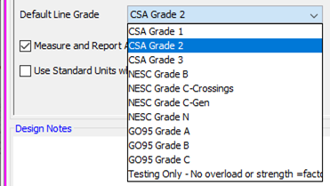
A Line Grade is a classification that different national standards apply to the importance of a line or set of structures. It is most efficient to set the most common Line Grade here for all items added to a project. Initially the value that is set in User Preferences is shown here as the default. You can always adjust specific items that require a different Line Grade individually later. All CSA and NESC Line Grades are available.

Anchor Leads from the Face of the Pole:
This is a preference setting that is specific to this specific project. Different geographic areas, and hence different projects, could have different requirements. This setting impacts the anchor lead lengths shown on reports and also the value presented for editing. The alternative to the measurements being from the front of the pole is from the exact center of the pole. Both methods have their merits. This setting has no impact on how anchor locations may be imported from data files using GIS coordinates.