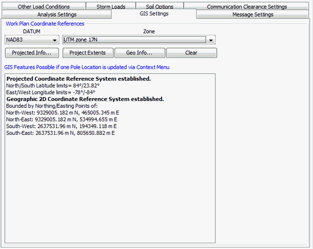
GIS Settings
GIS settings are optional as Quick Pole internally uses Easting / Northing (x,y) position values to calculate span lengths and angles. Quick Pole can work with or without GIS settings or coordinates. A few additional features are available (such as StreetView) and imports involving longitude and latitude, if GIS settings are also utilized.
The last Datum and Zone you have selected in Quick Pole is internally stored and used as the default values for new entries (including the import wizard). One exception is when you add a new Design to a project file that already has other Designs, the Datum/Zone of the first Design in the project file will be used as the default.
If you are editing the Datum/Zone for existing projects, the list of available zones will be limited to those that are applicable for the Latitude/Longitude range of the existing project.
If you set the Datum and UTM Zone, GPS coordinates in degrees can be converted to exact Northing/Easting values for internal calculations. It also helps line up base layer maps with your project.
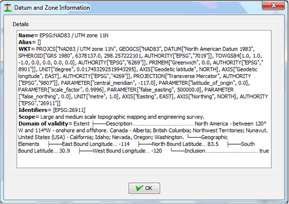
The Projected Info button can be used to get more detailed information on Datum selected to confirm you have made the best choice.